Today, almost everyone relies on Google Maps for navigation in road traffic. The tool is practical and provides good results when it comes to planning a route to a chosen address. However, recently, a Berlin-based artist made headlines by using 99 smartphones to outsmart Google Maps and create a virtual traffic jam. This is just one reason why transportation companies should rely on a professional route planner instead of Google Maps when it comes to planning routes for trucks.
Because Google Maps and other commonly used online route calculation tools quickly reach their limits when it comes to calculating truck-specific routes, they are not an ideal solution for transportation companies.

Can you select trucks as a vehicle option in Google Maps?
In Google Maps, you can select various types of vehicles, including bicycles and public transportation. However, there is no specific option for trucks. The system always calculates the fastest route for a car.
If a truck driver follows this navigation, they run the risk of entering roads that are not suitable for truck traffic or are simply blocked: environmental zones, bridges, or underpasses. In such cases, they may need to turn around. Delayed deliveries and a lot of frustration can be the result. The driver may even exceed their legally allowed driving time.
What does Google Maps not take into account in the truck route planning?
- Toll roads
- Environmental zones for transportation
- Driving and resting times
- Different vehicle profiles (including LHV & ADR)
- Truck parking areas
- Window times
- Loading and unloading times
And what can you do with professional truck route planning software?
- Plan truck-specific routes
- Sequence optimization
- Calculate times and distances
- Calculate truck toll costs
- Calculate transport costs
- Calculate CO2 emissions
- Perform bulk calculations in Excel
What functions does a professional truck route planner offer?
Truck-specific route planning
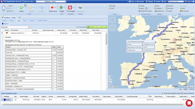
Truck-specific route planning: route planning based on a truck vehicle profile takes into account all restrictions that can affect trucks, including permissible clearance height, maximum weight, speed limits, environmental zones, and more.
In comparison to route planning in Google Maps, this typically results in completely different route guidance tailored to the needs and limitations of trucks.
Concrete example: City of Cologne
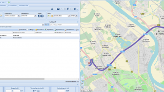
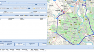
Currently, in Cologne, several bridges are closed to truck traffic. When creating a truck route with Google Maps, the tool suggests the shortest route, which may lead directly over one of the closed bridges. The consequence is that the driver encounters a roadblock, has to turn around, loses valuable time, and accumulates additional kilometers.
On the other hand, a professional truck route planner like PTV Map&Guide recommends a route that is suitable for trucks, taking into account such road closures and restrictions.
When comparing the distance information provided by the two route planners, one might be tempted to choose the shorter route suggested by Google Maps. However, in reality, the truck driver will have to turn around before reaching the bridge and switch to the longer route to avoid the roadblock.
Calculating Transport Costs for Each Route
How much truck toll do I have to pay? How can I determine transport costs for different routes?
In order to create a quote, freight forwarders need to determine the freight costs in advance. This is because truck toll costs along the route, fuel expenses, and the hourly rate for the driving personnel are essential components of transport costs.
Google Maps primarily serves as a mapping and navigation tool. It does not provide features for proactive planning or cost calculation.
In contrast, a professional truck route planner like PTV Map&Guide calculates the incurred transport costs for freight deliveries directly during route planning. This tool is aware of all toll sections throughout Europe, including both national roads and highways, as well as special tolls for bridges or tunnels. In addition to toll costs, PTV Map&Guide also takes into account vehicle and personnel expenses.
Using Google Maps for truck navigation?
First, let’s clarify the two terms: route planning and navigation. Simply put, in the logistics sector, we plan a route in advance at the office, determining how to get from point A to point B. We chart out the best route for your vehicle profile—the quickest, most efficient, and most cost-effective one. However, planning a route doesn’t guarantee that it will be followed.
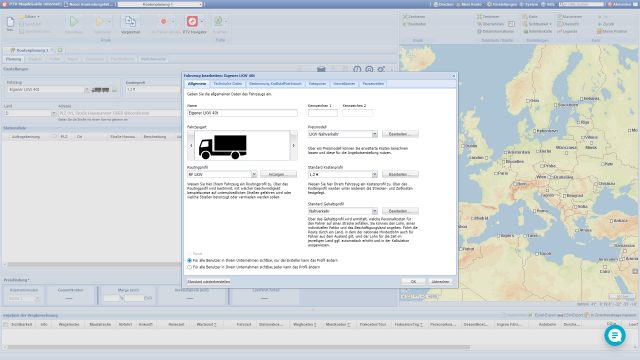
Navigation, on the other hand, involves executing the planned route step by step. Can you use Google Maps for truck navigation? Like route planning, this is also not recommended. A professional navigation system provides a solution by offering truck-friendly routes. It allows you to navigate based on your chosen vehicle profile, such as 40T or 20T.
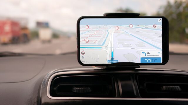
Truck navigation as a complement to PTV Map&Guide
As mentioned, Google Maps is not the correct choice when it comes to your route planning. Despite being widely used for car navigation, Google Maps falls short when it comes to truck navigation.
But why is truck navigation (think of the PTV Navigator) a must for drivers? And why is a “regular” navigation system not sufficient? The difference lies in the limitations, historical traffic information, dimensions, and exceptions of the vehicle profile. Not every truck can fit under every bridge, and not every cargo can pass through a residential area without issues. Navigation systems specifically designed for trucks create tailored routes based on your inputted vehicle profile, addressing these unique requirements and restrictions.
Conclusion: Why Google Maps is not suitable for trucks
A professional truck route planner not only provides the quickest and most efficient route from A to B but also plans and optimizes the sequential stops for the entire journey. It takes into account all relevant and individually important parameters, from restrictions such as tunnel limitations to the specific vehicle profile of the truck, transport costs, and even emissions calculations. Therefore, for those who want to maintain control over truck routes, transport costs, and delivery times, relying on Google Maps for trucks is not the preferable choice.

